Google making Map Maker data available for download

Starting with Kenya, Google is allowing users to download the base data collected through the Map Maker service, as either KML or Shapefile format. Google’s licensing allows for only non-commercial use. Hopefully, this data will support some of the non-profit mapping efforts taking place on the continent. The license also restricts (or at least, severely limits) competition with services provided by Google. This puts OpenStreetMap in an odd position – OSM is restricted from incorporating the data into its own service. Considering OSM has been around since 2004 and Map Maker only 2008, and seeing how many people in over 100 countries have been offering Google data, OSM needs to better align (or contrast) itself with the work Google is doing. One of the reasons I believe Map Maker has gathered the amount of user-generated content in the past year is that Map Maker is incredibly easy to use and if you do run into issues, there is clear and concise help. This is compared to the OSM Beginner’s Guide. Now, I understand that OSM is geared towards a more technical audience than the Map Maker service, but OSM needs to spend more time fostering a community outside of the devoted submitters. What is going to prevent Google from offering up a GIS service akin to the Virtual Earth on ArcGIS platform currently being offered by ESRI and Microsoft? A service built on TA/Navteq data, enhanced with local knowledge? A service that is available now from OSM, but much easier to use? Providing base data for Kenya is just the beginning.

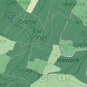
Mikel Maron has some more thoughts about OSM and Map Maker, as well as some comparison screenshots. (Via Mapperz)

Posted in Data, ESRI, Google, Microsoft, Web Mapping | Tagged , , , , , | 1 Comment

Architecture, five cents.

What was initially a concept project has ballooned into a movement promoting an open, candid discussion about local architectural issues. Architecture 5¢ is an attempt to get the public talking about architecture. I think this is a great idea – I feel the average person does not understand the roles architects, planners and engineers play in their lives everyday. Architecture should not be a practice reserved only for college graduates apprenticing at a firm.

Planners must make a push in this direction. Planning has to be approachable. We’re far less appreciated than architects and our work much less tangible. (Architects point to a building. What do we point to?) We know our work is important (and thankfully our clients know this, too) but that’s not enough. Planning is the key to uniting the individual buildings into a greater urban fabric.

The recent trend towards incorporating charrettes or visioning sessions is a step in the right direction. However, we must make our work (in draft and final form) as open and available as possible. Workshops and public hearings should be a part of every project. Planners need to excel at outreach and get the people and stakeholders involved to the greatest extent possible. GIS can aid in outreach efforts through coordination, presentation and as a feedback channel. We need to be at the forefront of all development projects, from major redevelopment down to streetscaping. If we don’t get the public involved, not only will we produce less effective planning documents, in their eyes we’ll be just another professional group billing a town.

Posted in In the News, Planning | Tagged , , , | 4 Comments

Web Mapping featured on Rowan’s homepage

Currently on Rowan’s homepage is an article on the Geography Department‘s work on bring GIS to the greater university community. The article focuses on our recent web mapping work; specifically the Land Use Change viewer and NJ State Atlas.  I’m quoted several times in the article, so I’m excited about that.

Direct link to the full article: http://www.rowan.edu/today/news/index/FS/118

Posted in In the News, New Jersey State Atlas, Updates, Visualization, Web Mapping | Tagged , , | Comments Off on Web Mapping featured on Rowan’s homepage

Geography of Luck – NJ Lottery winners mapped

I recently requested from the NJ Lottery a list of all the big prize winners, from 1988 to 2008. The winner’s location information is reported by ZIP Code, so I now have a map of the winners plotted out across the state and region.

Among the values mapped for each ZIP code area are the number of winners within, the total amount won, and a location quotient value that highlights areas where the number of winners in each ZIP code is far greater than the average distribution of winners throughout the state. Clicking on the map will highlight the ZIP code area selected, provide a summary of the statistics I have recorded, and allow you to see the entire list of winners by game, amount won and date.

So, here’s the Top 5 ZIP codes by number of winners, total amount one, and by location quotient ratio. The links will bring you to the Geography of Luck page.

Number of Winners

Amount Won

Location Quotient

  • 07842: 22.2007 (2 winners in a ZIP code of 47 people for a total of $1,374,417.60 won.)
  • 07428: 17.6869 (2 winners in a ZIP code of 59 people for a total of $20,000.00 won.)
  • 07970: 15.4585 (8 winners in a ZIP code of 270 people for a total of $318,703.00 won.)
  • 08036: 14.6081 (7 winners in a ZIP code of 250 people for a total of $288,700.44 won.)
  • 07846: 9.6618 (1 winner in a ZIP code of 54 people for a total of $20,000.00 won.)

The location quotient is the (number of winners in ZIP/total number of winners)/(number of people in ZIP/total number of people).

I’m still working on some additional functionality, so if you think of any way I can improve this (or any other map on NJ State Atlas), please let me know in the comments, or by leaving feedback on Get Satisfaction. This project is done entirely in my spare time, so please be understanding if something is broken or not-quite-yet-perfect.

Posted in Data, New Jersey State Atlas, Web Mapping | Tagged , , , | 4 Comments

Using Sketchup to visualize $1 trillion

This page has a visualization of the sheer size $1 trillion dollars would occupy using $100 bills. The images are rendered using SketchUp, one of my favorite applications.

I came across this link while browsing BoingBoing, and one of their comments I feel sums up much of what I feel nicely:

I love how the cost of making and sharing this diagram is still $0.00 no matter how big the problem.

Posted in SketchUp, Visualization | Tagged , | 1 Comment

Fun with Google Latitude

Kate was tracking my progress home tonight, as I was going to pick up Thai food along the way. I manually set my location to “Thailand” and found when I got home, Kate was very confused as to where I was. Setting my location to “Thailand” actually set me as being in “Nong Chaeng,” which I assume is the closest place name to Google’s center point for Thailand.

When will Google release an API for Latitude? It should also tie into OpenSocial, like how iGoogle and Orkut do now. Google has been really great in releasing new and innovative social networking components and applications, but they need to really follow through and support their creations. Offer up an API and the community will do the rest.

Posted in Google, Technology, Web Mapping | Tagged , , | 1 Comment

God help us.

GIS for Dummies has been released. Aren’t there already too many people abusing GIS?

Doesn’t the advanced nature of GIS preclude a “Dummies” book? I can understand Google Earth for Dummies, as that software is geared more towards general use, but this just baffles me.

Posted in Books, In the News | Tagged , , | Comments Off on God help us.

Ogle Earth on redaction of images from Google

Today, Ogle Earth has posted an excellent article on images from Google Earth that have gone missing. The imagery is of an area in Pakistan. Apparently Dianne Feinstein commented that the US military has been using a base in Pakistan for the staging and deployment of unmanned drones. This comment precipitated a chain reaction of reissued statements and denials. The images in question showed aircraft similar to those of the Predator drones. This image has since been removed from Google Earth and DigitalGlobe.

Ogle Earth sums up the issue quite well:

Did both Google and DigitalGlobe separately receive a request from a government (presumably the US, but possibly Pakistan) to remove this imagery from public scrutiny, and comply, or is there a contractual obligation/legal obligation on the part of Google to remove imagery from Google Earth if DigitalGlobe removes it from its product list? Did DigitalGlobe make a mistake in publishing the 2006 imagery available in the first place, considering that the US military has “shutter control” of the satellite’s cameras? Or perhaps (and I’m merely speculating), since the Predator drone operations are run by the CIA and not the US military, were shutter control orders somehow not properly relayed via the usual channels?

I’d love to find out exactly why the images were pulled. Once they’ve made the rounds, it’s almost pointless to remove them. Haven’t we learned from the Streisand Effect?

Posted in Data, Google Earth, Government, In the News | Tagged , , , , , | Comments Off on Ogle Earth on redaction of images from Google

Southwest Florida

Kate and I are down in Southwest Florida visiting her family. We drove down from New Jersey and used Google Latitude to share our location with her family and my parents. Kate and I also are taking some pictures using my GPS-enabled BlackBerry and are posting them on Flickr.

There probably won’t be many updates to NJ Geo and NJ State Atlas until I come back up next week.

Posted in Google, Technology | Tagged , , , , , | Comments Off on Southwest Florida

Apple rumored to include CoreLocation in 10.6

AppleInsider has a tip that the upcoming version of Mac OS X, dubbed “Snow Leopard” will incorporate the GPS and location-based services library from the iPhone into the laptop/desktop version of the operating service.

They postulate that “CoreLocation will utilize a Mac’s existing networking hardware to triangulate the system’s location in a manner similar to the way the original iPhone was able to use the technology to emulate a true global positioning signal.” Is the inclusion of GPS into future Apple laptops too foreign a concept? I’m holding out for the GPS-enabled Macbook Mini, a netbook running OS X smaller than the current offerings. With more and more location-based applications (BrightKite, Google Latitude) for mobile phones being released each day, why wouldn’t Apple start looking into including GPS into its computers?

via SlashGeo

Posted in Mac OS X, Technology | Tagged , , , , | Comments Off on Apple rumored to include CoreLocation in 10.6