In my previous post, I claimed that iPhoto was the culprit behind the mangling of the GPS coordinates embedded in my photographs. The problem likely lies in the Core Image library used throughout Mac OS X.
To see if other image editing applications exhibited the same geotagging flaw, I used a jpg right off of my camera and rotated and saved it in Preview, Apple’s default image viewer. This demonstration shows that the method used to write .jpg files alters the GPS coordinates stored in the EXIF metadata.
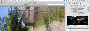
Preview does not seem to alter the coordinates upon reading the image…
Nor after rotating. I snagged the above during the save. Note that the coordinates are still the same as before.
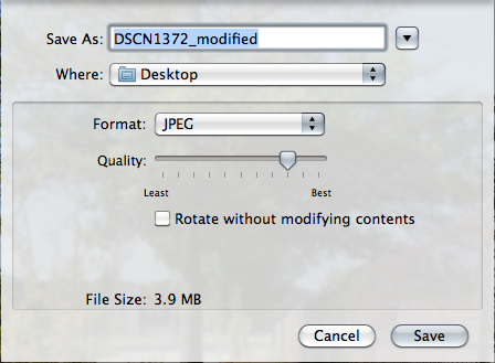
As soon as the save is complete, you can see the GPS tab in the Inspector window reflects the changed coordinates. Instead of saving in-place, choosing Save As presents you with an interesting option.
“Rotate without modifying contents.” Isn’t a rotate just a rotate? What else needs modification besides the array of bits? After a search on Google, it appears that when checking the box, it updates the EXIF information to reflect the change in orientation. While good for that purpose, Mac OS X modifies all of the EXIF data, not just the orientation data. Because the EXIF GPS implementation is broken, a save to disk that includes changes to EXIF data will also remove/modify the GPS coordinates. And sadly, Export from iPhoto does change the EXIF data.
I have emailed Apple and submitted a bug report, but have not heard anything as of yet. I will update you once I hear from them. This really bothers me because Apple seems to be strongly promoting geotagged photos (taken with the iPhone and managed in iPhoto) but is neglecting the need for high precision coordinates. (Aside: the GPS chips used in the iPhone are rated for 2m accuracy. Well under one arc second.) For now, I will have to rely on other software (probably on Windows) to manage my geotagged photos for our National Guard project.


